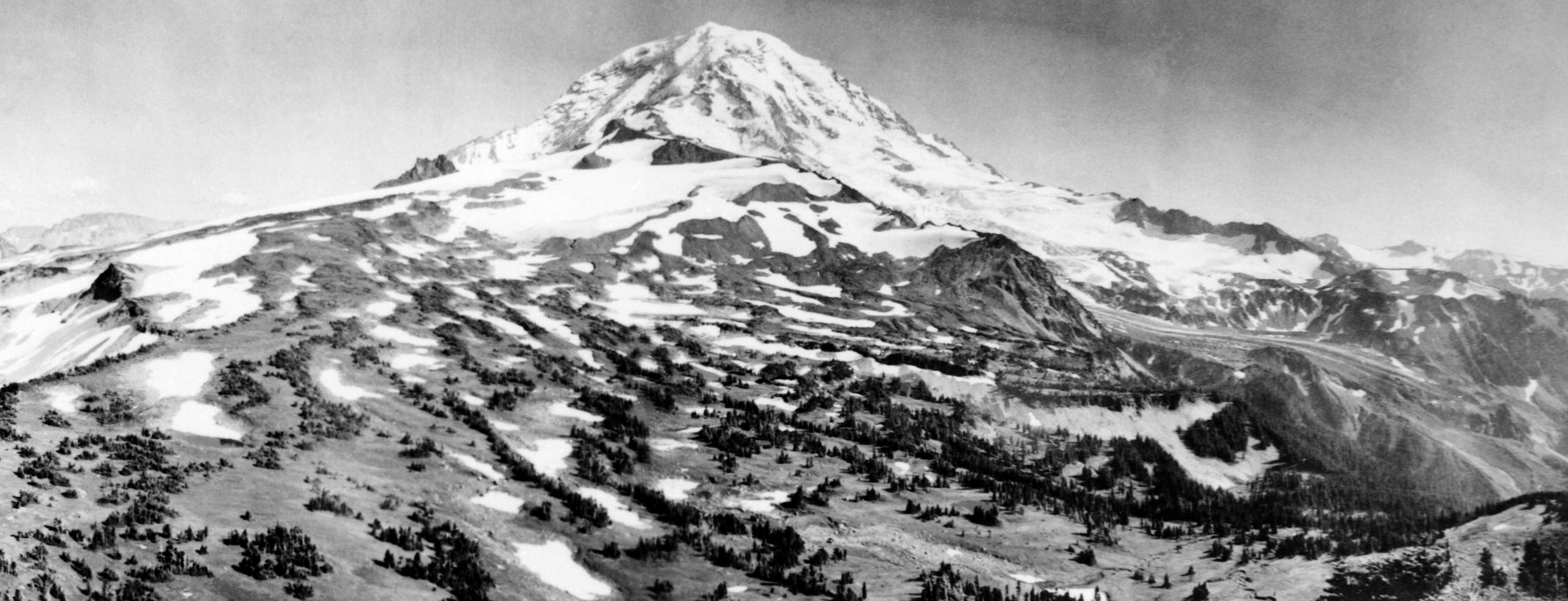
I’ve always been fascinated by old photographs, so last year when I found an old panoramic photo of Mt. Rainier in Pat Pringle’s excellent Roadside Geology of Mount Rainier National Park and Vicinity I got really excited. The photo was taken in 1904 by W.P. Romans, and shows the northwest slopes of the mountain in the vicinity of Spray Park. The original is maintained by the Washington State Historical Society
How much has this place changed in 110 years? The Pacific Northwest has warmed about 0.8C since the photo was taken, and we have quite a few lines of evidence from photographs and montoring that most of the Park’s glaciers have been in retreat. Unfortunately, we don’t have as much information about how alpine and sub-alpine ecosystems have responded. Has the treeline crept upwards over the last century?
Last summer, I set out to take a repeat photograph of Spray Park. First, I had to figure out where on earth WP Romans was standing. Google Earth was an invaluable tool for figuring this out, especially when I found out how to adjust the virtual camera’s field of view. Here’s my best shot at a re-creation of the photo using Google Earth.
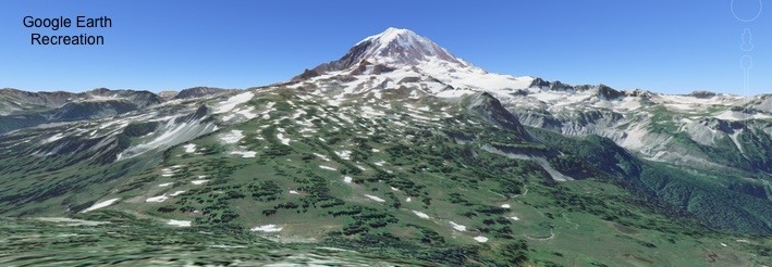
Turns out Romans must have been standing near the summit of Mt. Pleasant, 46.927667N, -121.838111W. After downloading the point into my GPS at the beginning of last summer, I didn’t think about it until September, when I was doing some field work in Spray Park that ended early, and there was just enough daylight left to grab the photo and get back to camp at Mowich Lake before dark.
It’s not a perfect re-creation. The original photo wasn’t dated, so the two photographs probably are not taken at exactly the same time of year. Judging from the shadows, I probably arrived a bit later in the day than Romans did as well.
Regardless, comparing the two photos is a lot of fun. I recommend you zoom in on the page a bit to help in the comparison.
My take is that the tree clumps along ridges have thickened considerably, but there’s not much recruitment of trees into the subalpine meadows between them. It would be cool to quantify this change somehow…